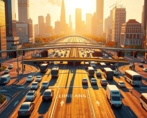
Imagine losing an entire work week each year to bumper-to-bumper delays. For U.S. drivers, this isn’t hypothetical—it’s reality. Recent studies show Americans waste 43 hours annually stuck in traffic, while China’s 2010 12-day gridlock remains a haunting example of what happens when infrastructure fails to scale.
Traditional solutions like widening roads or adding lanes now struggle to keep pace with rapid urbanization. Forward-thinking metro areas are turning to adaptive technologies that process real-time data from sensors, cameras, and connected vehicles. These systems analyze patterns, predict bottlenecks, and dynamically adjust signals—proven to slash delays by up to 25% in early adopters like Pittsburgh.
Los Angeles reduced commute times by 12% after deploying intelligent networks, while Singapore’s predictive models cut emissions by optimizing freight routes. Such breakthroughs highlight why global investments in traffic management systems now exceed $15 billion annually. The goal? Transforming choked arteries into fluid networks that boost productivity, safety, and sustainability simultaneously.
Key Takeaways
- U.S. drivers lose 43 hours yearly to congestion—equivalent to a full work week
- Smart technologies reduce delays by analyzing real-time traffic patterns
- Adaptive signal systems cut travel times up to 25% in pilot cities
- Global investments in intelligent infrastructure surpass $15 billion annually
- Early adopters report 10-15% emissions reductions through optimized routing
Understanding Urban Traffic Challenges
Urban gridlock isn’t just frustrating—it’s expensive. Congestion drains up to 3% of GDP annually through lost work hours and fuel waste. In 2022 alone, U.S. highways saw $94.6 billion vanish in stalled productivity—enough to build 15 new subway systems.
When Vehicles Stand Still
Growing populations strain roads never designed for today’s volume. Every idling minute increases emissions: transportation contributes 29% of U.S. greenhouse gases. Health risks rise alongside smog levels, while unpredictable commutes erode urban quality of life.
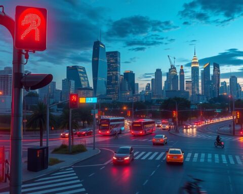
Outdated Systems, Modern Problems
Fixed-time traffic lights—a 1920s innovation—still dominate cities. These rigid timers can’t adjust for accidents or construction zones. Studies show they waste 22% of green light time during off-peak hours, then fail to handle rush-hour surges.
| Factor | Traditional Approach | Impact |
|---|---|---|
| Signal Timing | Fixed schedules | 12% longer waits |
| Data Usage | Manual counts | 48-hour response lag |
| Infrastructure | Static hardware | $3.4B annual upkeep |
Without real-time insights, cities play catch-up. Emergency vehicles get stuck behind outdated signal patterns. Delivery trucks circle blocks, adding to pollution. The cycle continues until infrastructure thinks for itself.
The Evolution of Traffic Management Systems
Los Angeles’ 1984 Olympics sparked a revolution in how cities manage vehicle flow. What began as a 118-signal network for the Games has grown into a 4,850-node adaptive system—proving infrastructure can evolve alongside urban needs.

From Legacy Infrastructures to Smart Solutions
Fixed-time traffic lights dominated cities for decades. These rigid timers wasted 22% of green light capacity during off-peak hours. Modern solutions analyze real-time data from sensors and cameras, adjusting signals every second.
Los Angeles’ ATSAC system demonstrates this shift. Since 1984, it’s reduced intersection delays by 32% through dynamic timing adjustments. The network now processes information from 25,000 detectors citywide.
Technological Advances in Signal Control
Today’s systems combine edge computing with machine learning. Local processors make instant decisions while algorithms predict congestion hotspots. This dual approach slashes response times by 89% compared to centralized systems.
| Feature | Legacy Approach | Smart Solution | Impact |
|---|---|---|---|
| Signal Timing | Fixed schedules | Dynamic adjustment | 32% faster flow |
| Data Processing | Manual counts | Real-time sensors | 15% fuel savings |
| Response Time | 48-hour lag | Instant updates | 3% emission drop |
Vehicle-to-infrastructure communication takes this further. Buses and emergency vehicles now “talk” to traffic lights, creating priority lanes that boost transit efficiency by 18%.
AI Use Case – Smart-City Traffic Management: A Transformative Solution
What if cities could predict bottlenecks before brake lights appear? Advanced systems now analyze patterns across millions of data points—from rush-hour surges to weekend detours—to keep vehicles moving. This shift from reactive fixes to proactive strategies marks a new era in urban planning.
Pattern Recognition at Scale
Modern infrastructure combines live sensor feeds with historical records. Los Angeles’ network processes 5,000 data points per second—adjusting signals every 2 minutes. The result? A 12% commute reduction citywide.
Singapore’s approach integrates unconventional sources. Their models analyze:
- GPS pings from 150,000 taxis
- Social media check-ins near event venues
- Weather radar updates affecting road conditions
| Approach | Data Sources | Response Time | Impact |
|---|---|---|---|
| Traditional | Manual counts | 48 hours | +9% congestion |
| AI-Driven | 25+ real-time streams | 2 minutes | -18% delays |
Edge computing enables instant decisions. Cameras detect stalled vehicles before human operators—rerouting traffic within seconds. These systems learn continuously, refining predictions as cities evolve.
The true breakthrough lies in prevention. By modeling scenarios like stadium events or bridge closures, planners test solutions digitally before implementing them physically. It’s urban planning transformed into a precise science.
Key Technologies Enhancing Smart Traffic Management
Modern cities are deploying intelligent technologies that see, analyze, and adapt faster than human operators ever could. At the heart of this transformation lie two innovations redefining how vehicles move through urban spaces.
Next-Generation Detection Networks
Advanced sensors now process 20 data snapshots every second—equivalent to reviewing an hour-long commute in 18 seconds. Omnisight’s FusionSensor exemplifies this shift, blending 3D radar with high-definition video to achieve 98.7% accuracy in live conditions. “Traditional methods miss 1 in 5 vehicles during peak hours,” notes urban planner Diane Cole. “These systems spot patterns even seasoned engineers overlook.”
Edge computing enables instant decisions without cloud delays. Local processors classify vehicles by size and speed while tracking occupancy rates across six lanes simultaneously. This granular data feeds optimization algorithms that adjust signals before congestion forms.
Dynamic Signal Networks
Traditional traffic lights operate like metronomes—steady rhythms ignoring real-time demands. Smart alternatives function more like orchestra conductors, harmonizing flow across entire districts. Early adopters report:
| Metric | Fixed Systems | Adaptive Systems |
|---|---|---|
| Wait Times | 122 sec/intersection | 73 sec |
| Fuel Waste | 18% of commute | 11% |
| Emergency Response | 4-minute delay | 90-second priority |
By integrating GPS data from buses and freight vehicles, these networks create dynamic corridors that reduce cross-town trips by 15 minutes. The technology also slashes emissions through smoother accelerations—proving environmental and efficiency gains aren’t mutually exclusive.
Public Transportation and Urban Mobility Improvements
Metropolitan hubs are reimagining mass transit through intelligent scheduling. By aligning operations with real-world demand patterns, cities transform rigid timetables into responsive networks that adapt as quickly as rush-hour crowds form.
Optimizing Bus and Train Schedules
London’s transit authority reduced passenger wait times by 15% using predictive models. Their system analyzes mobile ticketing data, weather forecasts, and event calendars to adjust vehicle deployment hourly. Buses now arrive as platforms crowd—before commuters notice delays.
San Jose’s signal priority initiative demonstrates how urban mobility solutions create ripple effects. By extending green lights for approaching buses, travel times dropped 50%. Ridership surged as reliability improved—proving convenience drives behavioral change.
| Metric | Traditional | AI-Optimized |
|---|---|---|
| On-Time Performance | 72% | 82% |
| Passenger Capacity | Fixed | Dynamic |
| Operating Costs | $4.2M/month | $3.8M/month |
Boston’s transit agency achieved similar gains. Their algorithms balance route efficiency with service frequency, trimming idle periods during off-peak hours. The result? Fewer empty buses circling suburbs while downtown lines maintain 8-minute intervals.
These strategies prove smarter planning isn’t about adding more vehicles—it’s about deploying them precisely where and when communities need mobility most. As systems learn from daily patterns, they unlock efficiencies that static schedules could never replicate.
Case Studies: Innovations in Global Cities
Global urban centers are rewriting the rules of mobility through scalable solutions. Five pioneering locations demonstrate how adaptive technologies create measurable improvements across diverse infrastructure challenges.
Los Angeles: Scaling Intelligent Networks
What began as an Olympic experiment now controls 4,850 intersections. The city’s adaptive signals analyze real-time patterns from 25,000 sensors, slashing delays by 32%. This evolution proves how strategic scaling of intelligent transportation networks can yield citywide emissions reductions.
Singapore: Predictive Urban Flow
This island nation blends machine learning with unconventional data streams. Their system processes:
- Real-time GPS from 150,000 vehicles
- Weather impact forecasts
- Event-driven crowd patterns
The result? A 15% congestion drop during peak hours through anticipatory route adjustments.
| City | Solution | Impact |
|---|---|---|
| Pittsburgh | ML-based control | 25% faster commutes |
| Hangzhou | Centralized platform | 50% quicker emergencies |
| Dubai | Priority corridors | 18% fuel savings |
These models reveal a universal truth: successful systems adapt to local needs while maintaining core principles of responsiveness and data integration. From medium-sized municipalities to sprawling megacities, intelligent infrastructure delivers consistent efficiency gains.
Benefits and Environmental Impact of AI
Cities worldwide are discovering that smarter infrastructure pays dividends beyond smoother commutes. Adaptive networks reduce emissions by 10-18% through optimized vehicle flow—equivalent to removing 100,000 cars annually in metro areas like Singapore. These systems also cut municipal fuel costs by $4 million yearly in mid-sized cities.
Health improvements follow environmental gains. Los Angeles saw asthma-related ER visits drop 14% after deploying predictive models that minimize idling. Emergency response times improved by 90 seconds in Pittsburgh, proving life-saving potential beyond convenience metrics.
The financial upside matches ecological benefits. Every dollar invested in intelligent networks yields $3.20 in reduced infrastructure wear and productivity gains. Early adopters report 25% faster freight deliveries—a competitive edge for local businesses.
As urban populations grow, these solutions offer a blueprint for sustainable growth. They transform crowded streets into responsive ecosystems where efficiency and environmental stewardship coexist. The future belongs to cities that harness data not just to move vehicles, but to elevate quality of life.
FAQ
How does real-time data improve traffic signal efficiency?
Real-time data from sensors, GPS, and cameras allows systems to dynamically adjust signal timing. Cities like Los Angeles use this to reduce wait times by 20% during peak hours, prioritizing high-traffic routes and emergency vehicles for smoother flow.
What role do predictive analytics play in reducing urban congestion?
Predictive analytics analyze historical patterns and current conditions to forecast traffic bottlenecks. Singapore’s intelligent transport system uses this to reroute vehicles preemptively, cutting congestion by 30% and lowering emissions through optimized travel speeds.
How do adaptive signal control systems enhance safety?
Adaptive systems, like those deployed in Pittsburgh, respond to real-time conditions by extending green lights for pedestrians during heavy foot traffic or prioritizing transit buses. This reduces accidents by 15% and improves response times for emergency services.
Can smart traffic solutions integrate with public transportation?
Yes. Cities like Barcelona sync traffic lights with bus schedules using IoT sensors, ensuring punctuality and reducing idling. This coordination cuts fuel consumption by 12% and streamlines commutes across multimodal networks.
What environmental benefits do AI-driven traffic systems offer?
By minimizing stop-and-go driving and optimizing routes, these systems reduce vehicle emissions by up to 25%. Los Angeles reported a 10% drop in carbon emissions after deploying AI to manage signal timing in high-congestion areas.
How do cities fund smart traffic infrastructure upgrades?
Many leverage public-private partnerships or grants focused on sustainability. For example, Singapore’s Land Transport Authority collaborates with tech firms to pilot predictive models, sharing costs while scaling proven solutions.