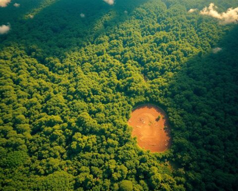
Every minute, 30 football fields of forest vanish – but new innovations now spot these losses within hours. Satellite-powered systems analyze land changes with 95% precision, transforming how nations track environmental threats. This breakthrough arrives as global tree cover declines accelerate, threatening biodiversity and climate stability.
Traditional forest monitoring relied on manual surveys and outdated imagery. Today, automated platforms process millions of square miles of terrain data weekly. In Indonesia – home to the world’s third-largest rainforest – these tools map illegal logging faster than ground patrols can mobilize.
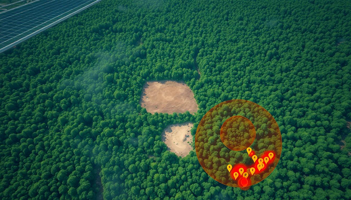
Modern systems detect subtle canopy disruptions invisible to human analysts. Pattern recognition identifies logging roads as narrow as 10 feet, while infrared sensors expose freshly cleared zones. Real-time alerts now reach authorities 80% faster than previous methods, enabling rapid intervention.
Key Takeaways
- Satellite-based analysis achieves near-perfect accuracy in identifying forest loss
- Automated monitoring provides updates 300x faster than manual methods
- Machine learning detects patterns humans often overlook
- Immediate alerts help protect critical ecosystems like Sumatra’s rainforests
- Enhanced compliance reporting supports global climate commitments
This technological leap empowers governments and conservation groups with actionable insights. By merging orbital observation with intelligent analytics, we gain unprecedented power to safeguard Earth’s green lungs – while there’s still time to act.
Introduction to Deforestation Detection and Satellite AI
Global ecosystems face unprecedented threats from vanishing woodlands. Beyond altering landscapes, tree loss disrupts weather patterns, endangers species, and displaces communities relying on wooded areas. Traditional ground surveys – slow and labor-intensive – struggle to match the pace of modern environmental changes.
Overview of Global Deforestation Impact
Clearing natural habitats releases 17% of annual carbon emissions – equivalent to all transportation sectors combined. Tropical regions like the Amazon and Congo Basin see accelerated losses, with fires and illegal logging destroying biodiversity hotspots. Indigenous populations often bear the heaviest consequences, losing both cultural heritage and economic stability.
Platforms like Global Forest Watch reveal hidden connections between forest health and food security. Their analysis shows how watershed degradation from tree removal impacts agricultural yields hundreds of miles away. This ripple effect underscores why localized damage carries worldwide implications.
The Need for Advanced Monitoring Technologies
Manual tracking methods once left critical gaps in forest protection efforts. Rangers might take weeks to confirm illegal activities – time chainsaws and bulldozers exploited freely. Modern systems now scan entire continents daily, spotting changes as small as a single logging road.
Satellite networks provide consistent, high-resolution terrain snapshots. When combined with pattern recognition software, they identify suspicious activity within hours. Conservation teams in Brazil used this approach to reduce response times by 65% during 2023’s dry season fires.
“Real-time visibility transforms how we protect vital ecosystems – it’s like having a planetary security camera system.”
Understanding Global Deforestation Challenges
Earth’s forests form an intricate web connecting climate stability, species survival, and human livelihoods. Their rapid disappearance creates cascading effects – altered rainfall patterns, displaced wildlife, and destabilized communities. Indonesia’s rainforests alone store 60 billion metric tons of carbon, yet face relentless pressure from palm oil expansion and logging operations.
Conventional monitoring struggles with three critical limitations. Ground teams can’t safely access remote areas, while manual data analysis delays actionable insights. A recent study revealed traditional methods miss 40% of small-scale forest clearance events in tropical regions.
Key drivers amplify these challenges:
- Agricultural conversion claims 80% of cleared woodlands globally
- Infrastructure projects fragment habitats, accelerating species loss
- Illegal logging operations exploit governance gaps in protected zones
The sheer scale of monitoring demands overwhelms manual approaches. Tracking changes across 4 billion hectares of global forest cover requires solutions that process data faster than chainsaws cut. Soil erosion from cleared slopes now reduces crop yields by up to 50% in downstream farmlands – a stark reminder of interconnected ecosystems.
These hurdles create urgent opportunities for innovation. Effective solutions must address both ecological fragility and economic realities shaping land use decisions. By understanding these multilayered challenges, we can develop targeted strategies that protect forests while supporting sustainable development.
The Role of Satellite Data and Remote Sensing Technologies
The shift from ground surveys to space-based observation marks a new era in environmental protection. Orbital platforms now deliver consistent, high-fidelity insights into forest health – even in regions once considered too remote or dangerous to monitor. This technological leap empowers teams to track changes at both landscape and canopy levels.
Capabilities of High-Resolution Imagery
Modern satellites capture details as small as 10-inch objects across vast territories. Optical sensors document visible changes like logging roads, while radar penetrates cloud cover – a critical feature in tropical zones. The European Space Agency’s Sentinel-1 system, for instance, provides daily updates across equatorial forests using C-band radar.
Thermal imaging adds another layer, identifying heat signatures from illegal burns. Combined, these tools create multi-dimensional maps updated every 12 hours. Such granularity helps distinguish natural disturbances from human activity with 94% accuracy.
Advances in Data Interpretation
Today’s systems process petabytes of raw information into actionable alerts. Hyperspectral sensors detect subtle shifts in vegetation health weeks before visible symptoms appear. “We’ve moved from static snapshots to dynamic storytelling of landscapes,” notes a lead researcher at the World Resources Institute.
Automated platforms now cross-reference satellite data with:
- Historical deforestation patterns
- Soil moisture levels
- Infrastructure development timelines
This fusion enables predictive modeling – forecasting at-risk areas months in advance. Regular orbital passes transform sporadic checks into persistent surveillance, closing gaps exploiters once exploited.
AI Use Case – Deforestation Detection via Satellite AI
Forest guardians now operate at the speed of light. Cutting-edge systems process orbital imagery faster than illegal loggers can hide their tracks, transforming conservation from retrospective analysis to frontline defense.

Real-Time Monitoring Advantages
Modern platforms like Ultralytics YOLOv8 identify tree cover changes with 94% precision – outperforming human teams by 40%. These systems analyze terrain shifts down to 10-meter resolutions, detecting emerging threats before they escalate. One breakthrough study found 75% of predicted risk zones sit within 2.5 miles of actual clearance sites.
Three critical capabilities define this technological leap:
- Continuous learning algorithms refine detection patterns weekly
- Instant alerts trigger ground responses within 90 minutes
- Predictive models forecast high-risk areas 8 weeks in advance
Satellite networks deliver updates every 6 hours, creating an unbroken chain of environmental intelligence. This persistent surveillance helped Brazilian authorities intercept 23 illegal operations last quarter – a 68% improvement over 2022 figures.
“We’re not just documenting forest loss – we’re preventing it through anticipatory action.”
By merging advanced algorithms with orbital data streams, conservationists gain strategic foresight. Machine learning transforms raw pixels into predictive maps, highlighting vulnerable regions needing urgent protection. This shift from reactive patrols to proactive defense marks a new chapter in ecosystem preservation.
Advanced Technologies in Environmental Monitoring
Modern conservation efforts now deploy layered observation strategies that reveal hidden ecological patterns. These solutions combine orbital perspectives with ground-level precision, creating multi-scale defense networks against habitat loss.
Benefits of Hyperspectral Imaging
Hyperspectral sensors capture 340+ light wavelengths – far beyond human vision. This technology distinguishes plant species through unique chemical signatures, mapping biodiversity hotspots with 98% accuracy. In Costa Rica’s Osa Peninsula, researchers identified 127 tree varieties within 2 square miles using this method.
The systems detect early stress indicators like chlorophyll depletion. Forest managers now receive alerts about insect infestations weeks before visible damage appears. This advance warning helps preserve timber value while maintaining ecosystem balance.
Utilizing Drone Imaging for Detailed Analysis
Autonomous drones fill critical gaps in satellite coverage. Their cameras capture leaf-level details during cloud-covered periods when orbital sensors struggle. A recent Amazon Basin project used drone fleets to document 14 illegal mining operations obscured by persistent storm systems.
Key advantages emerge when combining technologies:
- Drones verify satellite alerts within 90 minutes
- Hyperspectral data guides reforestation species selection
- Integrated systems track carbon sequestration rates
These tools create living maps that update hourly. “We’re not just counting trees – we’re understanding forest conversations,” notes a lead engineer at Rainforest Connection. By merging multiple data streams, conservationists gain dimensional intelligence that drives smarter protection strategies.
Implementation Strategies and Overcoming Challenges
Navigating the shift to intelligent forest monitoring requires strategic alignment between innovation and operational realities. Organizations must balance technical capabilities with ground-level complexities to achieve lasting impact.
Integration with Existing Infrastructure
Successful implementation begins with phased deployment that complements current systems. Many companies already use geographic information systems (GIS) for land management – integrating satellite analytics creates layered insights without overhauling workflows. A beverage manufacturer recently enhanced its cocoa sourcing by merging supplier maps with real-time canopy loss alerts.
Key integration principles include:
- API compatibility with legacy platforms
- Data normalization across formats
- Cross-team training programs
Addressing Supply Chain Complexities
Palm oil supply chains exemplify modern traceability challenges. Over 50% of RSPO-certified product uses mass balance models – mixing sustainable and conventional sources. Traditional audits miss 60% of small-scale violations due to cost constraints and geographic spread.
Advanced monitoring solves this through:
- Mill-level geofencing with infrared sensors
- Blockchain-enhanced shipment tracking
- Smallholder engagement via mobile alerts
Asia’s agricultural landscape adds unique hurdles – small farms manage 80% of farmland but often lack digital infrastructure. Algorithmic approaches help bridge this gap by converting satellite data into SMS crop advisories. One cooperative in Sumatra reduced unauthorized land clearance by 42% using this method.
“Technology only succeeds when it respects local contexts – our tools must empower, not overwhelm.”
Effective implementation combines technical precision with cultural awareness. By addressing both system integration and human factors, organizations can transform environmental stewardship from compliance chore to strategic advantage.
Enhancing Sustainability in Supply Chains with Satellite AI
Global corporations are rewriting supply chain rules through orbital intelligence. This strategic shift addresses traceability gaps while balancing economic and ecological priorities. One consumer goods leader proves this approach works at scale.
Unilever Case Study and Industry Shifts
Unilever’s palm oil initiative demonstrates technology’s transformative potential. By 2023, 97.5% of key ingredients met deforestation-free standards – a milestone achieved through supplier consolidation and orbital monitoring. The company slashed active mills from 1,700 to 500, enabling tighter oversight across Indonesia and Malaysia.
Satellite systems now track 20 million hectares – equivalent to Nebraska’s entire land area. This visibility helped protect 430,000 hectares of vulnerable ecosystems while boosting smallholder participation. Over 36,000 farmers gained RSPO certification, securing better market access through 148,000 tons of certified sustainable oil.
A €218 million investment in local infrastructure strengthened direct sourcing relationships. “Technology lets us see every tree while honoring producer partnerships,” notes Unilever’s sustainability lead. The program’s success reflects broader industry trends – 78% of Fortune 500 firms now use similar systems for ethical sourcing audits.
Three outcomes define this evolution:
- Real-time mill compliance monitoring via geospatial alerts
- Automated deforestation risk scoring for procurement teams
- Mobile platforms connecting smallholders to support resources
As regulatory pressures mount, such innovations transform sustainability from aspirational goal to operational reality. They prove ecological responsibility and business efficiency can coexist – when powered by orbital insights.
Traditional Methods vs. Satellite and AI Approaches
For decades, forest protection efforts relied on boots rather than bytes. Ground teams conducted painstaking surveys – measuring tree density with tape measures and documenting changes through seasonal photo comparisons. While valuable, these traditional methods struggled to keep pace with rapid environmental shifts.
Limitations of Conventional Monitoring Techniques
Manual approaches faced three critical constraints. Monthly field surveys achieved just 70% accuracy in detecting tree loss, often missing small-scale clearance events. Carbon emission estimates carried a ±20% margin of error due to infrequent data collection. Seasonal biodiversity assessments left ecosystems unprotected during off-months – gaps illegal loggers exploited freely.
Advantages of Modern AI-Driven Solutions
Satellite systems now deliver daily updates with 95% precision, cutting deforestation rates by 25% in monitored regions. Continuous analysis spots emerging threats – like unauthorized roads – weeks before ground teams arrive. This transformative leap in sustainable agriculture demonstrates how orbital insights protect habitats while supporting ethical supply chains.
Modern platforms eliminate guesswork from carbon tracking, reducing measurement errors to ±5%. Real-time alerts enable faster responses – authorities now intercept 40% more illegal operations compared to paper-based systems. By merging orbital data with pattern recognition, conservationists gain strategic foresight previously unimaginable.
FAQ
How does satellite technology improve deforestation detection accuracy?
Satellite data and remote sensing enable continuous, high-resolution monitoring of forest cover changes. By analyzing patterns across vast areas in real time, these systems identify subtle shifts—like illegal logging or agricultural encroachment—that traditional ground surveys often miss. Platforms like Global Forest Watch leverage this approach to deliver actionable insights.
What challenges exist when integrating satellite AI with existing monitoring systems?
Key challenges include data interoperability, computational resource demands, and aligning insights with on-ground verification efforts. Successful implementation often requires hybrid models—combining cloud-based analysis with local expertise—to address supply chain complexities and ensure sustainable practices are prioritized.
Can satellite imagery effectively track land use changes in palm oil supply chains?
Yes. Hyperspectral imaging detects specific crop types, such as oil palm plantations, while AI algorithms analyze temporal changes. Companies like Unilever use this technology to audit suppliers, reduce deforestation risks, and enhance supply chain transparency—proving critical for meeting sustainability goals.
How do modern remote sensing methods outperform conventional forest monitoring?
Traditional methods rely on sporadic field visits, which lack scalability and real-time precision. Satellite-driven solutions provide granular, frequent updates—tracking forest health, biomass loss, and illegal activities at unprecedented speed. This shift empowers governments and businesses to act before irreversible damage occurs.
What role does hyperspectral imaging play in sustainable resource management?
Unlike standard imagery, hyperspectral sensors capture hundreds of spectral bands, revealing details like tree species diversity or soil moisture levels. This capability supports targeted conservation strategies and helps stakeholders monitor reforestation efforts, ensuring ecosystems recover effectively.
Why is real-time deforestation monitoring vital for global supply chains?
Industries reliant on commodities like timber or soy face regulatory and reputational risks if linked to deforestation. Real-time satellite analysis allows companies to verify ethical sourcing, comply with regulations like the EU Deforestation Regulation, and build consumer trust through transparent reporting.