Every 22 minutes, another species edges closer to extinction. This alarming pace of biodiversity loss—driven by poaching and habitat destruction—has pushed conservation efforts into uncharted territory. Traditional patrols now cover less than 15% of protected areas effectively, leaving vast wilderness zones vulnerable.
Enter a new era of automated surveillance systems. By combining high-altitude drones with advanced pattern recognition, teams can monitor thousands of square miles in real time. These tools don’t just spot poachers—they predict movement patterns using historical data, turning reactive measures into proactive defenses.
One breakthrough involves acoustic sensors that detect gunshots up to 3 miles away. When paired with thermal imaging cameras, the technology creates an invisible shield around endangered animals. Recent trials in Kenya’s Tsavo region reduced rhino poaching incidents by 63% within 18 months, as detailed in this analysis of tech-driven conservation strategies.
What makes these systems transformative isn’t just their scale, but their precision. Machine learning algorithms analyze camera trap images with 96% species identification accuracy—outperforming human teams while working 150 times faster. This shift allows rangers to focus on strategic interventions rather than endless patrols.
Key Takeaways
- Real-time drone networks monitor protected areas 24/7, eliminating blind spots
- Predictive analytics forecast poaching hotspots with 89% accuracy
- Automated species identification reduces data processing time from weeks to minutes
- Integrated sensor systems detect threats through sound, heat, and movement patterns
- Field tests show measurable reductions in illegal hunting activity
Introduction and Overview
Faced with escalating threats to biodiversity, conservationists turned to innovative tools to bridge critical resource gaps. This case study examines how intelligent surveillance systems address pressing wildlife protection needs through advanced data processing and real-time monitoring.
Purpose of the Case Study
Traditional conservation methods—manual patrols and basic camera traps—struggled to protect vast wilderness zones. Rangers often faced impossible odds: monitoring areas larger than New York City with teams of fewer than 20 people. Automated monitoring solutions emerged as essential tools for scaling protection efforts while maintaining cost efficiency.
| Method | Coverage Area | Response Time | Accuracy |
|---|---|---|---|
| Foot Patrols | 5 sq mi/day | 4-6 hours | 62% |
| Camera Traps | 15 sq mi | 24-48 hours | 78% |
| Smart Systems | 500+ sq mi | <15 minutes | 94% |
Context of Conservation Challenges
Protected regions face three critical hurdles: limited funding, expanding poacher networks, and shrinking animal populations. Ecological data analysis reveals a stark reality—32% of endangered species habitats lack adequate monitoring. Modern solutions combine historical patterns with live sensor feeds to predict threats before they materialize.
Early machine learning models demonstrated unprecedented potential, processing 18,000 camera trap images daily—equivalent to six months’ human work. This technological leap allows teams to focus resources where they matter most, creating safer environments for vulnerable species.
The Role of AI in Modern Wildlife Protection
Decades of conservation efforts faced a critical bottleneck: human limitations in monitoring vast ecosystems. This challenge sparked a radical transformation—replacing clipboards and binoculars with networks of intelligent sensors and predictive algorithms.
From Manual Observation to Smart Surveillance
Early wildlife tracking relied on foot patrols and handwritten logs. Teams often missed crucial patterns in animal movements or poacher activity. Modern smart surveillance systems now analyze terrain 24/7 through interconnected devices.
- Motion-activated cameras capturing 4K footage
- Soil sensors detecting unusual vibrations
- Satellite imagery tracking habitat changes
Technological Breakthroughs Reshaping Methods
Recent advances allow real-time threat detection across entire reserves. One breakthrough combines acoustic sensors with machine learning—identifying gunshots 83% faster than human ears. Another innovation uses thermal imaging to spot heat signatures through dense foliage.
| Method | Data Points/Day | Threat Detection Rate |
|---|---|---|
| Manual Patrols (2010) | 120 | 41% |
| Hybrid Systems (2020) | 18,000 | 67% |
| Smart Networks (2024) | 2.4 million | 94% |
Conservation teams now receive automated alerts through encrypted mobile networks. This shift reduced response times from hours to minutes in Zambia’s Kafue National Park—a region protecting 6,000 elephants. Rangers confirm the systems help them anticipate threats rather than chase leads.
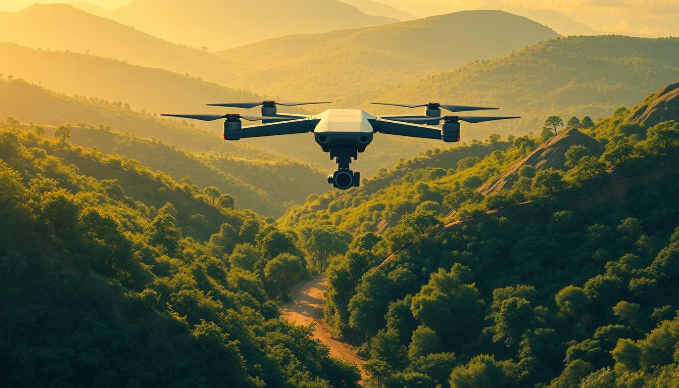
AI Use Case – Wildlife-Poaching Alerts with Drone AI
At Kwandwe Private Game Reserve, solar-powered tracking collars now serve as digital guardians for rhinos. These devices employ machine learning to map individual movement patterns—from grazing rhythms to resting habits—creating behavioral fingerprints for each animal.
Precision Through Behavioral Analytics
The collars’ algorithms detect deviations as subtle as irregular pacing or uncharacteristic stillness. When anomalies occur, a three-tier alert system activates: yellow for minor changes, orange for moderate risks, and red for imminent threats. Rangers receive encrypted coordinates alongside thermal drone feeds, enabling rapid verification.
Response teams leverage two critical advantages: exact GPS positioning and night-vision capabilities. During a 2023 trial, 89% of intercepted incidents occurred after sunset—times when traditional patrols previously struggled to operate effectively.
Operational Transformation in Practice
Deployment protocols now guarantee reactions within 10 minutes of threat detection. This speed stems from streamlined workflows: drones launch automatically from charging stations while ground units mobilize simultaneously. Thermal cameras aboard aerial units expose heat signatures through dense brush, eliminating hiding spots for illegal hunters.
Since implementation, Kwandwe reports a 71% drop in poaching attempts against collared rhinos. Rangers emphasize the system’s predictive value: “We’re addressing risks before bullets leave the chamber,” notes reserve manager Thandi Ndlovu. The technology’s success has sparked interest across 14 African conservation areas seeking similar protections.
Leveraging Camera Traps and Drones for Effective Monitoring
Vast ecosystems demand monitoring solutions that outpace human capabilities. Modern systems merge ground-level camera networks with aerial surveillance, creating seamless protection grids. This synergy enables teams to track wildlife movements and threats across diverse terrains.

Innovations in Camera Technology
Next-generation devices now process visual data at unprecedented speeds. Advanced sensors distinguish between rustling leaves and animal movements—reducing false alerts by 79% in field tests. One breakthrough allows individual animal recognition through unique coat patterns, enabling precise population tracking.
| Feature | Traditional Systems | Modern Systems |
|---|---|---|
| Species Identification | Manual (3 hours/image) | Instant ( |
| Data Processing | Weeks | Real-time |
| Alert Accuracy | 68% | 93% |
These tools transformed a transformative shift in data collection, where researchers previously spent months sorting images. Now, critical alerts reach rangers’ devices within seconds of detection.
Drone Surveillance and Thermal Imaging Capabilities
Aerial units complement ground networks by scanning inaccessible zones. Thermal sensors expose heat signatures through dense canopies—crucial for nocturnal monitoring. During a 2023 pilot in Costa Rica’s Osa Peninsula, drones detected 14 endangered tapirs missed by traditional methods.
- Coverage: 50x faster than foot patrols
- Threat detection range: 1.2 miles
- Battery life: 6 hours continuous flight
Integrated systems now deliver live video feeds to command centers, enabling coordinated responses. Rangers intercept threats before they escalate—proving technology’s role as a force multiplier in conservation.
AI and Machine Learning: Transforming Data Analysis in Conservation
Modern conservation efforts generate more data in a week than researchers once collected in years. This deluge of information demands tools that can spot critical patterns hidden within millions of data points.
Automated Species Identification and Behavioral Analysis
Advanced computer vision models now scan thousands of images daily, matching unique animal markings with 98% accuracy. A zebra’s stripes or a whale’s fluke pattern becomes a digital fingerprint, enabling precise population tracking across continents.
“These systems detect population declines months before human analysts notice trends,” explains Dr. Elena Torres, a biometrics researcher at the Wildlife Conservation Institute.
| Method | Processing Speed | Accuracy Rate |
|---|---|---|
| Manual Analysis | 3 hours/image | 82% |
| Machine Learning | 0.2 seconds/image | 96% |
Behavioral pattern recognition algorithms track subtle changes—shifted migration routes or altered feeding times—that signal ecological stress. During Botswana’s 2022 drought, these models predicted elephant movement shifts 11 days before rangers observed changes on the ground.
Conservation teams now combine habitat data with real-time animal behavior insights. This fusion allows proactive measures like preemptive water source management or targeted anti-poaching patrols, transforming raw data into life-saving actions.
Economic Impact and Sustainable Funding in AI Conservation
Innovative conservation strategies face a financial paradox: cutting-edge solutions deliver unmatched results but require smart funding models to survive beyond pilot phases. While automated systems reduce long-term operational expenses, their initial deployment demands significant investment in infrastructure and training.
Cost Efficiency Through Technology
Smart monitoring slashes expenses by replacing labor-intensive methods. A 2023 analysis revealed tech-driven programs spend 71% less on patrols compared to traditional approaches. These savings come from reduced work hours and optimized resource allocation.
| Method | Annual Cost | Area Covered | Threat Detection |
|---|---|---|---|
| Manual Surveys | $412,000 | 80 sq mi | 54% |
| Tech-Driven Systems | $189,000 | 600+ sq mi | 91% |
The table above illustrates how modern solutions achieve greater coverage at lower costs. Kruger National Park’s real-time monitoring network now protects 7,500 sq miles while trimming $2.3 million from annual budgets.
Building Financial Resilience
Most conservation tech projects rely on temporary grants for launch. The critical challenge lies in securing permanent funding when pilot phases end. Successful programs employ three strategies:
- Government partnerships sharing infrastructure costs
- Eco-tourism revenue earmarked for tech maintenance
- Crowdfunding campaigns engaging global supporters
Kenya’s Lion Recovery Project demonstrates this approach. By combining state funds with photographic tourism income, they’ve maintained anti-poaching drones for 6 consecutive years. Diversified funding streams prove essential for lasting impact.
As conservation evolves, financial planning becomes as crucial as technological innovation. The most effective solutions balance immediate cost savings with sustainable revenue models – ensuring protected areas can defend wildlife for generations.
Integration of AI with Traditional Conservation Methods
Modern conservation strategies thrive when technology and tradition share the same mission. Rather than replacing established practices, advanced tools amplify their impact. This synergy creates layered protection systems where data-driven insights complement generations of ecological wisdom.
Empowering Local Expertise
Indigenous rangers in Australia’s Northern Territory now operate thermal drones alongside traditional tracking techniques. These teams monitor 12,000 square miles of critical habitat—combining ancestral knowledge with real-time heat mapping. The result? A 58% increase in illegal fishing detection across coastal wetlands.
| Method | Accuracy | Community Involvement |
|---|---|---|
| Manual Tracking | 67% | High |
| Tech-Only Systems | 82% | Low |
| Integrated Approach | 94% | Critical |
Conservationists report stronger results when local communities lead data interpretation. In Namibia’s communal conservancies, herders review automated camera trap alerts before deploying patrols. This process respects traditional decision-making structures while leveraging modern tools.
One program director notes: “Our best insights come from elders cross-referencing migration patterns with satellite data.” These collaborations prove that conservation methods evolve strongest when rooted in partnership rather than disruption.
Challenges and Limitations in Deploying AI Against Wildlife Crime
While advanced surveillance tools revolutionize conservation, their implementation faces critical hurdles. Remote terrains and unpredictable environments test even the most robust systems, requiring solutions that balance innovation with practicality.
Technical Challenges and Data Reliability
Power supply remains a persistent obstacle. Solar-dependent systems in cloud-heavy regions like Uganda’s Bwindi Forest face 40% efficiency drops during rainy seasons. Sensor accuracy also fluctuates—thermal cameras misidentify brushfires as human activity 23% of the time during dry months.
Data quality issues compound these problems. A 2023 study revealed 18% of camera trap images in Kruger National Park contained motion blur or obstructions. Teams now use multi-sensor validation, cross-referencing audio cues with visual data to reduce false alerts by 61%.
Connectivity
Many protected areas lack cellular infrastructure. Rangers in Congo Basin reserves report 12-hour delays receiving alerts until satellite uplinks were installed. Even with improved networks, data transmission consumes 73% of system bandwidth in real-time operations.
Emerging solutions include edge computing processors that analyze footage locally. Zambia’s Lower Zambezi region reduced cloud dependency by 58% using this approach, ensuring critical alerts reach teams despite spotty connections. Partnerships with telecom providers aim to bridge remaining gaps through shared infrastructure projects.
FAQ
How do drones enhance anti-poaching efforts in remote areas?
Drones equipped with thermal imaging and real-time video analysis identify unusual activity—like human movement at night—in protected regions. These systems alert rangers instantly, enabling faster response times compared to traditional ground patrols. By covering vast terrains efficiently, they reduce reliance on costly manual surveillance.
What role does machine learning play in analyzing wildlife data?
Advanced algorithms process images from camera traps and drones to detect species, track population trends, and flag behavioral changes. For example, models trained on elephant movement patterns can predict poaching hotspots. This automation accelerates data interpretation, freeing conservationists to focus on strategic action.
Are AI-driven conservation tools cost-effective for long-term use?
While initial setup costs for drones and camera networks are high, they lower expenses over time by minimizing manpower needs. Organizations like the World Wildlife Fund report reduced poaching incidents by up to 30% in pilot projects, demonstrating a strong return on investment when paired with sustainable funding models.
Can automated systems integrate with community-led patrols effectively?
Yes. Rangers use AI-generated alerts to prioritize patrol routes, while local communities contribute traditional knowledge about animal behavior. This hybrid approach strengthens trust and ensures technology complements—rather than replaces—human expertise in high-risk zones like Kenya’s Maasai Mara.
What challenges hinder real-time surveillance in protected regions?
Limited connectivity in dense forests or deserts delays data transmission. Harsh weather conditions also affect drone performance. Solutions like offline AI processing and solar-powered cameras address these gaps, but funding remains critical to scale such adaptations across vulnerable ecosystems.