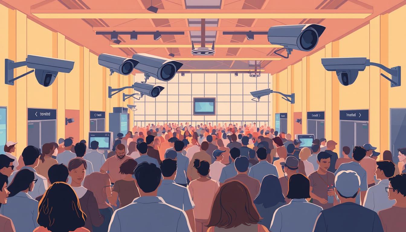
Standing in a packed concourse, many leaders recall a moment when a slow decision nearly became a crisis. That memory drives a simple goal: prevent harm and preserve trust.
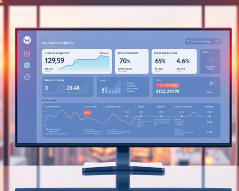
The guide frames a practical roadmap that turns raw data into decisive action. Modern spatial intelligence—3D sensing and LiDAR, combined with cameras and edge/cloud systems—delivers live heatmaps, fast alerts, and precise people counts.
This approach moves teams from reactive to proactive. Managers gain real-time monitoring for better staff allocation, clearer reporting, and faster response during events. Anonymous sensing protects privacy while improving safety and security.
The piece previews technical choices, step-by-step implementation, and an example of unified operations that shortens detection-to-action cycles and smooths crowd flow.
Key Takeaways
- Real-time monitoring turns data into faster decisions for safety and security.
- 3D sensing plus cameras produces accurate counts and live heatmaps.
- Edge/cloud hybrids detect critical thresholds in seconds for dynamic management.
- Anonymous sensing balances privacy with actionable insights.
- Unified systems lower risks, improve flow, and protect reputation.
Why Crowd-Density Analytics Matters Now for U.S. Venues
Modern venues face a narrow window where crowds shift from orderly to hazardous in minutes.
Urgency is real: packed areas can reach unsafe capacity in under 15 minutes. More than 78% of operators lack real-time visibility, so small congestion issues become serious risks fast.
Traditional video surveillance and manual headcounts miss key bottlenecks. Legacy cameras often fail to spot 72% of emerging choke points and introduce average delays of 45 seconds before alarms reach staff.
Intelligent platforms analyze thousands of movement points per second, predict density shifts, and send live heatmaps and alerts. That lets security teams reroute flows, reduce overcrowding, and protect guest safety before incidents escalate.
Readers of this guide will learn how to set thresholds, deploy continuous monitoring at critical entry and exit zones, and fold alerts into operational playbooks. A simple example: a rising heatmap near exits during an encore triggers alternate-route staffing and eases congestion within minutes.
For a practical reference on event check workflows, see this event check-in example.
Choosing the Right Technology Stack: LiDAR, Computer Vision, Edge, and Cloud
Selecting hardware and architecture defines the speed and accuracy of detection across busy public spaces. This decision affects occupancy metrics, alert latency, and operational resilience.
LiDAR-powered spatial intelligence offers uninterrupted 3D monitoring that works regardless of light or occlusion. It produces anonymous point-clouds that support GDPR/CCPA alignment and precise people counting. Traditional camera analytics face limits with glare, crowding, and low light; LiDAR fills those gaps.

Edge vs. Cloud: speed and scale
Edge devices deliver sub-second alerts and keep detection running during outages—typical triggers occur in about 0.8 seconds. Cloud layers add cross-site analysis and trend aggregation, with multi-venue context available in roughly 3.2 seconds.
Privacy, integration, and outcomes
Anonymous sensing avoids identifiable video while enabling live heatmaps, configurable density thresholds, and reliable counts. Integrations with VMS platforms and feeds (for example Milestone XProtect or Genetec) centralize alerts and automated reports.
- Multi-sensor fusion (cameras + LiDAR) raises coverage in concourses and transition areas.
- APIs and SDKs speed policy setup and alert routing for operations teams.
- Calibration aligns thresholds with space geometry and egress capacity.
| Capability | LiDAR | Camera-based | Edge + Cloud |
|---|---|---|---|
| Accuracy in dense crowds | High—3D point-clouds | Lower—occlusions affect counts | Combined: improved with fusion |
| Lighting dependence | Independent | Needs good light | Edge mitigates; cloud refines |
| Alert latency | ~0.8s at edge | Variable | Edge: sub-second; Cloud: seconds |
| Privacy profile | Anonymous point-clouds | Video may be identifiable | Policies enforce retention and audits |
For deeper technical context and system benchmarks, consult this research overview. Together, these choices deliver measurable benefits: faster detection, fewer escalations, and data that guides targeted capital improvements.
AI Use Case – Crowd-Density Analytics in Venues: A Step-by-Step Implementation
Operational readiness grows from precise goals, staged tests, and diverse training sets.
Define goals and thresholds first. Map objectives, set zone-specific safety limits, and document data requirements for each event type and space profile. Clear planning reduces ambiguity for staff and tech teams.
Collect and label diverse scenarios next. Gather footage from night events, rainy days, drills, and festivals so the analysis handles real-world variance. Annotate queues, bidirectional movement, and stall points to reveal hidden patterns.
Train, validate, and calibrate
Split datasets to track precision and recall. Tune thresholds to lower misses without burdening teams with false alerts. Include anonymized silhouettes of people and individuals across attire and density to boost robustness.
Operationalize detection outputs. Translate alerts into playbooks: who is notified, which mitigations apply per zone, and what escalation steps follow. Use APIs and tools to route notifications into incident platforms for fast action.
- Pilot in limited zones and stress test during surges and outages.
- Document governance: change controls, retention rules, and audit trails.
- Close the loop: post-event reviews refine thresholds and improve management over time.
For a technical roadmap and development guidance, consult this crowd monitoring development guide.
Integrating with Existing Security Systems and Operational Playbooks
When systems share context, operators validate events faster and dispatch the right teams without delay.
Connecting VMS, access control, and alerting tools for unified responses
Spatial platforms integrate with VMS like Milestone XProtect and Genetec to surface prioritized alerts next to live cameras and incident logs. This unifies surveillance, video, and analytics so leaders see one clear view for faster response.
Designing staff workflows for dynamic allocation and proactive interventions
Configure routing rules to send alerts to security, guest services, or facilities based on zone and severity. Standardize playbooks that document who acts, expected time-to-response, and handoffs between roles.
“A VMS alert can trigger a recorded PA message and dispatch floor teams in under a minute.”
- Pair alerts with approved crowd control tactics — open gates or redirect queues.
- Use historical congestion maps for staffing and planning ahead of events.
- Run drills that train staff to interpret alerts and coordinate field responses.
Measure operational health by tracking mean time to response and resolution. Iterate dashboards, thresholds, and automation rules with frontline feedback to improve management and reduce incidents.
From Monitoring to Action: Alerts, Predictive Analytics, and Continuous Optimization
When systems translate movement into clear directives, staff move from watching to managing crowds. Rapid detection must connect to defined steps so monitoring becomes proactive management.
Setting density thresholds, anomaly detection rules, and zone-based policies
Operationalize thresholds: define density limits per zone and attach specific alerts to each level. That way, monitoring triggers precise actions instead of vague warnings.
Edge devices spot critical density in under two seconds. Pair those signals with zone policies so staff know who acts and which mitigations apply.
Live heatmaps, intelligent routing, and peak-time congestion reduction
Use live heatmaps to guide routing and lower congestion during peak times. Predictive analysis compares current flow with historical movement to flag hotspots minutes ahead.
Combine people counting and anomaly detection: when dwell spikes, systems send pre-scripted responses—open alternate routes, reroute queues, or stagger egress—to reduce risks fast.
Measuring impact: response times, incident reduction, capacity compliance, guest experience
Track KPIs: time to response, incident counts, capacity compliance, and guest satisfaction. These metrics show whether policies cut congestion and improve safety.
Close the loop: review false alarms and misses, update models, and refine playbooks. Scale successful policies across similar areas for broader improvements.
| Objective | Typical Measure | Target | Benefit |
|---|---|---|---|
| Detection to alert | Seconds | <2s at edge | Faster response, less escalation |
| Peak congestion reduction | % drop in dwell | 20–40% | Smoother flow and better experience |
| Response time | Mean time to response | -30% vs baseline | Fewer incidents and lower risks |
| Capacity compliance | Occupancy % vs limit | 95% compliance | Regulatory alignment and comfort |
Conclusion
Treating movement patterns as measurable signals turns uncertainty into predictable responses. Spatial intelligence and LiDAR deliver anonymous, high‑accuracy monitoring that works day or night and across indoor and outdoor zones. Edge/cloud architectures push rapid alerts to staff and give leaders cross‑site trend data for planning.
Prioritize thresholds, integrated systems, and clear playbooks. Real‑time heatmaps and VMS/BMS connections let staff reroute flows, reduce overcrowding, and cut response times. Privacy remains core: anonymous sensing and limited retention build trust while protecting people.
Measure success by fewer congestion incidents, faster responses, and better guest flow. For deeper technical context on spatial solutions and field results, see this spatial intelligence overview.
FAQ
What is crowd-density analytics and how does it help U.S. venues?
Crowd-density analytics uses sensors, camera feeds, LiDAR, and edge or cloud processing to count people, map movement, and detect unsafe concentrations. For venues—stadiums, convention centers, festivals—this technology helps managers spot congestion early, reduce bottlenecks, and improve evacuation planning while protecting guest safety and experience.
Why is this technology critical right now for venue operators?
Large events and higher guest expectations increase risk: packed areas can reach unsafe density within minutes. Manual monitoring and static cameras often miss fast surges. Automated analytics provide continuous oversight, sub-second alerts, and data for smarter staffing and capacity decisions.
What sensor choices should venues consider: LiDAR versus traditional cameras?
LiDAR delivers precise spatial point-clouds and robust people counting in varied light and weather; cameras offer rich visual context and are cost-effective for many deployments. Best practice blends both—LiDAR for anonymous, accurate density and cameras for broader situational awareness—balancing accuracy, privacy, and cost.
How do edge and cloud processing differ, and when should each be used?
Edge processing provides low-latency, on-site alerts and resilience during network issues; cloud processing aggregates multi-venue data for trend analysis and long-term optimization. Use edge for real-time safety responses and cloud for cross-event analytics and historical reporting.
How is privacy maintained when monitoring crowds?
Privacy by design includes anonymous point-clouds, on-device aggregation, and limited retention. Systems can avoid facial recognition, follow GDPR/CCPA principles, and publish clear policies so guests trust how data is collected and used.
What are practical steps to implement a crowd-density solution?
Start by defining safety goals and density thresholds for each space. Collect labeled scenarios—rushes, low light, weather events—then train and validate models. Pilot in targeted zones, refine alert rules, and scale gradually while documenting operational changes.
How do venues integrate analytics with existing security systems?
Integrations connect the analytics platform with VMS, access control, and mass-notification tools to trigger automated alerts and actions. Define APIs and workflows so alerts map to staff roles, dispatch protocols, and escalation playbooks for unified responses.
What operational changes are needed for staff to act on analytics?
Design dynamic staffing plans and clear SOPs tied to density levels. Train teams on dashboard alerts, rapid redeployment, and crowd steering techniques. Regular drills with the system improve response times and reduce false alarms.
Which visualization tools are most useful for real-time crowd management?
Live heatmaps, zone-based dashboards, and trend graphs help teams spot hotspots and predict flow. Intelligent routing maps and mobile alerts allow staff to reroute crowds and reduce peak congestion before incidents occur.
How do venues measure the impact of crowd-density systems?
Track metrics such as average response time to alerts, incident reduction, capacity compliance, queue times, and guest satisfaction. Use baseline data before implementation, then compare post-deployment results to quantify safety and operational gains.
How do systems handle difficult scenarios like low light, rain, or rapid surges?
Robust deployments combine sensor diversity, environmental labeling in training sets, and adaptive thresholds. Edge-based models tuned with real-world events and periodic recalibration reduce false positives and missed detections in challenging conditions.
Can analytics predict congestion before it happens?
Yes—predictive models use historical patterns, live counts, and event schedules to forecast near-term surges. Predictive alerts enable proactive interventions: opening gates, redirecting flow, or calling additional staff ahead of peak moments.
What are common pitfalls when deploying crowd-density systems?
Pitfalls include unclear objectives, insufficient labeled data, poor integration with operations, and ignoring privacy concerns. Mitigate these by defining measurable goals, piloting with diverse scenarios, and aligning technology with staff workflows and legal requirements.
Which stakeholders should be involved in a deployment?
Include security directors, operations managers, IT, legal/privacy officers, and event planners. Engaging frontline staff and venue leadership early ensures the system meets safety, technical, and compliance needs while gaining operational buy-in.
How scalable are these solutions for multi-venue operators?
Modern platforms are designed to scale: edge nodes handle local, real-time tasks while cloud services aggregate data for enterprise dashboards, benchmarking, and centralized policy enforcement. This enables consistent standards across venues while preserving local resiliency.