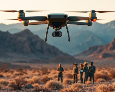
Many farmers stand at the edge of a cornfield at dawn. They feel a quiet urgency. Every decision they make today affects tomorrow’s yield.
For U.S. agribusiness leaders, this feeling is paired with curiosity. They wonder how technology can help them make better decisions. This article looks at how AI helps farmers make decisions based on evidence.
The focus is on how technology helps farmers. It uses drones, sensors, and AI to analyze images. This helps farmers make better decisions for their fields.
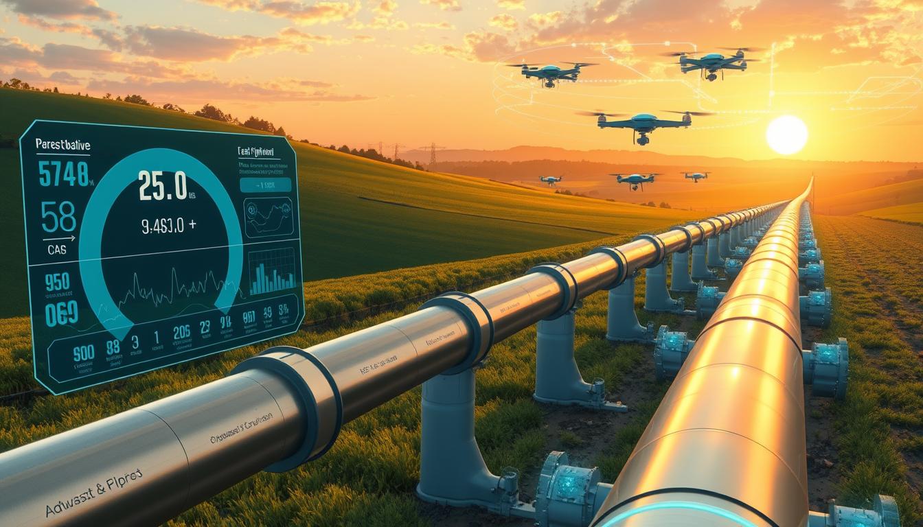
Market signals show the opportunity is big. The global agri-drone market is expected to grow a lot. Investors are also showing their confidence in this technology.
Drone technology combines aerial views, sensors, and AI. It gives farmers important information like where to water and where pests are. This helps farmers use less and grow more.
For farmers in the U.S., this technology is very useful. It helps them manage large areas of land. They can make changes in real-time, thanks to technology.
This section is about a practical analysis. It’s for entrepreneurs, agribusiness leaders, and innovators. They want to know if investing in precision agriculture is worth it.
Key Takeaways
- AI Use Case – Precision-Farming Drone Imagery Analysis translates aerial data into actionable farm management insights.
- Precision agriculture combines drones, multispectral sensors, and AI in agriculture to improve yields and cut costs.
- Drone analytics market growth and venture funding signal rapid adoption of smart farming technology.
- High-resolution imaging supports large-scale U.S. operations with sub-5cm detail and autonomous coverage.
- Adoption centers on measurable outputs: irrigation alerts, NDVI mapping, and targeted pest detection.
Understanding Precision Farming
Precision farming uses sensors, data, and automation. It helps manage field differences and use resources better. This method tackles challenges like growing populations, changing weather, less land, and fewer workers.
Definition and Importance
Precision agriculture divides fields into zones. Farmers use specific actions for water, fertilizer, and protection. This boosts yields and cuts waste.
NDVI mapping is key. It shows stress and nutrient needs early. This helps farmers act fast to protect crops and use less chemicals. Tools like Farmonaut and PrecisionHawk help make decisions easier with 3D maps.
Key Technologies in Precision Farming
Smart farming combines aerial, ground, and cloud tech. Drones take high-quality images for crop health and spray planning. DroneDeploy and PrecisionHawk turn these images into useful maps.
IoT soil sensors and robots give detailed field data and automate tasks. Self-driving tractors and sprayers need less labor. Farm management systems connect all these, making decisions easier with cloud analytics and AI.
| Technology | Primary Use | Performance Benchmark |
|---|---|---|
| Agricultural drones | High-res imaging, spraying | Sub-5cm accuracy; fleets survey up to 1,000 ha/day |
| NDVI mapping | Early stress detection | Detects nutrient issues before visible symptoms |
| IoT soil sensors | Moisture and nutrient monitoring | Enables site-specific irrigation scheduling |
| Robotics | Autonomous field operations | Replaces manual tasks; consistent application |
| Cloud analytics & AI | Prescriptive recommendations | Real-time agricultural image analysis and alerts |
| Satellite imagery | Large-area monitoring and traceability | Integrates with farm management systems for ROI tracking |
Real-world data shows the impact. AI drones can cover a lot of land fast and use less pesticides. Leher has shown big spraying and efficiency gains. Learn more at Leher AI-powered drones.
These technologies work together. They create a system that turns data into smart decisions. This change helps farmers manage better, not just react.
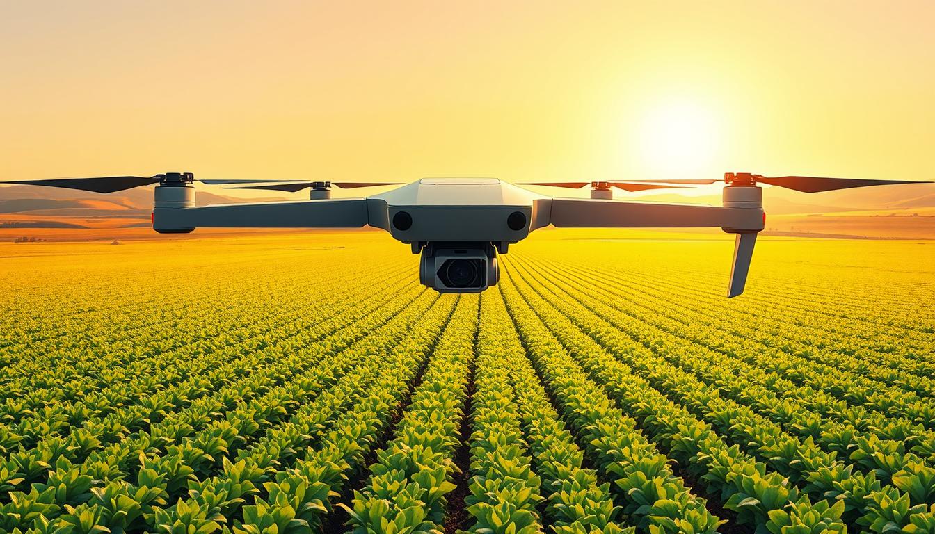
Introduction to Drone Technology in Agriculture
Drone technology in farming has changed a lot. It used to be just for the military. Now, it helps farmers manage their fields better.
Early drones had RGB, multispectral, hyperspectral, and thermal sensors. Farmers now use drones to check their fields often. This gives them high-resolution data for quick decisions.
Evolution of Drone Use in Farming
Drone use grew as sensors got lighter and batteries lasted longer. Edge AI and better internet allowed drones to fly further and analyze data faster. Today, drones can map fields very accurately.
They can show where water collects and where plants are stressed. This helps farmers make better choices.
Types of Drones for Agricultural Applications
Choosing the right drone depends on what you need to do. Fixed-wing drones can fly for a long time. They can cover a lot of ground but need space to take off.
Multirotor drones, like quadcopters, are great for close-up work. They can spray or take pictures of specific areas. They don’t need as much space.
Hybrid drones are a mix of both. They can take off vertically and then fly far. Foldable drones are easy to carry and don’t lose much performance.
Building a drone system involves many parts. It needs strong materials, motors, and sensors. It also needs good software to work well.
| Attribute | Fixed-wing drones | Multirotor drones | Hybrid / Foldable |
|---|---|---|---|
| Endurance | 90–480 minutes | 15–60 minutes | 60–240 minutes |
| Best use | Large-area mapping, high-res surveys | Hover inspection, targeted spraying | Mixed missions; remote access |
| Coverage per flight | 1,200+ hectares possible | Small to medium fields | Variable, mission-dependent |
| Takeoff/Landing | Needs space or launcher | Vertical lift; small footprint | VTOL capability |
| Typical sensors | Multispectral, thermal, RGB | RGB, multispectral, sprayers | Combination packages |
Drone use has big benefits. It can cut down on chemicals and save a lot of time. Some drones can spray up to 50 acres a day.
When choosing drones, think about what you need to do. Fixed-wing drones are good for big areas. Multirotor drones are better for close work. Hybrid drones offer a mix of both.
For more information on drone technology in farming, check out this guide: drone technology in agriculture.
Benefits of Drone Imagery in Agriculture
Drone imagery changes how we work in fields. It makes complex data easy to understand. Farmers can see how crops are doing, what it costs, and what risks there are.
Increased Efficiency and Reduced Costs
Field surveys used to take days but now take hours. Drones can cover a lot of ground fast. This means less work for people and machines.
Drone spraying is much faster than old ways. It can be 2–5 times quicker. This makes work go faster and saves fuel and wear on machines.
Drone data helps make better supply choices. It shows where to use inputs, saving chemicals and seeds. This can save 20–40% of inputs.
Enhanced Crop Monitoring and Management
Drone flights give maps of crops in near real-time. These maps show problems before we can see them. This lets farmers act fast to save crops.
Thermal sensors help save water by finding where it’s needed. This makes irrigation smarter and saves water.
Drone pictures help plan planting and track assets. Tools from PrecisionHawk and Farmonaut make it easier to manage and track things.
- Environmental gains: Targeted inputs reduce runoff and shrink the environmental footprint.
- Compliance and traceability: Integrated records help ESG reporting and supply-chain transparency.
- Operational insight: Drone analytics feed decision systems that prioritize time-sensitive tasks.
Drone imagery doesn’t replace expert farmers. It helps them make better decisions faster. This protects crops and saves money.
How AI Enhances Drone Imagery Analysis
AI in agriculture makes drone footage useful for farms. It finds problems, sorts crops from weeds, and suggests how to water or use fertilizers. This helps farmers and experts make better choices.
Machine Learning Algorithms in Agriculture
AI uses special networks to analyze farm images. It spots pests and weeds and tracks how crops grow. By combining different models, it can guess how much crops will yield.
AI gives farmers maps and alerts. It shows where crops are healthy or sick, where to water, and how much to grow. This info helps farmers manage their land better.
Real-Time Data Processing Capabilities
AI works on drones in two ways. The drone itself does some work, and the cloud does more. The cloud improves the AI over time.
AI sends farmers alerts right away. It tells them when to water, if pests are coming, and where to add nutrients. It works with many tools to get the job done.
Getting AI to work well takes a lot of work. Farmers need to label data and keep training the AI. Studies show AI can be very accurate, even better than humans in some cases.
Use Cases of AI in Drone Imagery Analysis
AI helps drones make quick decisions for farmers. It’s all about spotting problems early and saving resources. Here’s how drones and AI change farming.
Crop Health Assessment
Drone pictures turn into important data like NDVI. This helps farmers check on their crops fast. AI learns what these pictures mean for the health of plants.
AI helps find issues in crops like wheat and veggies early. Tools like PrecisionHawk show farmers where to add water or fertilizer. Drones can see small differences in fields that people can’t.
Soil Quality Monitoring
Drone pictures and sensors help check soil health. They show where the soil is wet, dry, or has the right mix of nutrients.
Drone sensors find where water is needed most. A study from Virginia Tech shows drones help plan better for planting and feeding crops. This makes farming more precise.
Pest and Disease Detection
AI spots pests and diseases before they’re seen. It’s very good at finding weeds in rice and pests in tomatoes. This means farmers can act fast.
Using drones saves on chemicals and time. Farmers can now spray only where needed. This also means they can plant seeds more carefully and even help pollinate plants.
- Impact on operations: faster scouting cycles, fewer blind spots, and data-driven task lists for crews.
- Scalability: workflows scale from small growers to large farms with repeatable survey plans.
- Cost-efficiency: targeted interventions reduce input waste and labor hours per acre.
Data Collection Techniques with Drones
Drones change how teams capture field data. The right imaging sensors and cameras are key. They help AI learn and support big operations in agribusiness.

Imaging sensors and cameras
RGB cameras are great for visible mapping and detailed orthomosaics. They can capture images with sub-5 cm detail. This helps count plants, find rows, and create 3D models.
Multispectral sensors capture visible and near-infrared bands. They make vegetation indices like NDVI. This is key for spotting stress early and monitoring large areas.
Hyperspectral imaging captures many narrow bands. It shows nutrient needs, diseases, and crop types. But, it costs more and needs more data handling.
Thermal sensors look at canopy temperature. They help with irrigation and spotting drought early. This is before you can see symptoms.
Multispectral vs. hyperspectral imaging
Go for multispectral imaging if you’re on a budget. It’s cheaper and works well with common drones and software like DroneDeploy or Pix4D.
Choose hyperspectral imaging for detailed tasks. It’s for nutrient mapping, disease spotting, and crop fingerprinting. But, it takes longer to process and needs more storage.
Flight planning and sampling are important. Keep flight altitude and overlap the same. Use ground control points and reflectance panels for accurate measurements. Good weather and time of day help reduce errors.
Choose your drone wisely. Fixed-wing drones cover a lot of ground. Multirotor drones do detailed work. Hybrid and foldable-wing drones are good for both.
Use drone data with ground truth from probes and tests. This makes AI training better. Use DJI Mobile SDK, DroneDeploy, or Pix4D for easy data processing. For more on drone use in agriculture, see a study on airborne platforms and protocols.
| Sensor Type | Primary Use | Typical Output | Tradeoffs |
|---|---|---|---|
| RGB cameras | High-res mapping, plant counts | Orthomosaics, DSMs | Limited spectral information |
| Multispectral imaging | Vegetation indices, stress detection | NDVI maps, band composites | Moderate data size, good cost balance |
| Hyperspectral imaging | Chemical and physiological signatures | High-dimension spectral cubes | High cost, heavy processing needs |
| Thermal sensors | Irrigation and drought monitoring | Canopy temperature maps | Sensitive to ambient conditions |
Field teams need to match payload, flight plan, and ground tools. A balanced setup helps AI learn and gives useful insights.
Analyzing Drone Data with AI
Drone imaging makes lots of data. We need to make sense of it. This part talks about how to do that and how it helps farmers. We’ll use tools that are easy to use.
Image Processing Techniques
First, we fix the images. We use tools like Pix4D to make them right. This makes sure the data is good.
Then, we find important features. We look at how green the plants are and their height. This helps us see if plants are stressed.
Next, we sort the images. We find the plants, weeds, and soil. This helps us know what’s going on in the field.
We also watch how things change. This helps us find problems fast. It means we can act quickly.
Predictive Analytics in Agriculture
Now, we use the data to predict things. We look at how green the plants are and the weather. This helps us guess how much we’ll get from our crops.
We also give advice on how to take care of the crops. This includes how much water to use and when to spray. It helps farmers make the best choices.
We find unusual things in the field. This helps farmers focus on what really needs attention. It saves time and effort.
We use special tools to make these predictions. These tools help us train the models and make them work fast. This means we can make decisions quickly.
We make it easy to see the results. We use dashboards and maps. This helps everyone understand the data. It makes it easier to work together.
We check if our predictions are right. We compare them to what’s really happening. This makes us more confident in our predictions.
Integrating Drones into Precision Farming Systems
Drones help a lot when they work with other systems. They plan missions, collect data, analyze it, and act on it. This makes aerial views useful for quick actions on the ground.
Workflow Automation
Tools like DroneDeploy plan drone flights. They set paths and upload images to the cloud. This makes getting data faster.
Cloud AI analyzes the images. It shows data in apps and to farmers. These apps send alerts and help with spraying.
Many drones can work together. This lets them cover more land with little help. It keeps farms up to date with field data.
Collaboration with Other Agricultural Technologies
Working with IoT devices makes drone data better. Soil sensors and weather stations add to the drone’s view. This makes plans for water and fertilizer more accurate.
Drone maps guide robots and tractors. They help with spot treatments and save water and fertilizer. This makes farming more efficient and less wasteful.
Satellites and drones are a team. Satellites give a big view, and drones give detailed pictures. Together, they help farmers make better choices.
APIs and platforms help drones work with other systems. They connect drones to farm management systems. This makes tracking and reporting easier.
Rules and safety are important too. Drones must follow rules and keep data safe. This ensures farming is done right and can be checked later.
Challenges and Limitations of Drone Imagery
Drone imagery is a big help in precision farming. But, there are limits that slow down its use. Things like technical issues, rules, and cost are big hurdles.
Data privacy and security concerns
Farm data needs to be kept safe. This includes things like field maps and crop info. Without good security, this data can get lost or stolen.
Keeping data safe means using strong passwords and checking for updates often. This helps protect against hackers.
Rules for keeping data safe and sharing it are important. They help farms follow the law and keep their data safe.
Regulatory issues in agricultural drone use
Rules control what drones can do. In the U.S., the FAA has rules for drone use. These rules include who can fly and where.
Following these rules can be hard. Farms have to know the rules in their area and talk to regulators. This takes time and money.
Adoption barriers, costs, and technical complexity
Drone systems can be very expensive. They cost thousands of dollars. Plus, there are ongoing costs for things like software updates.
Drone use is also limited by weather and battery life. Farms have to fly drones again and again to get good data. This takes more time and money.
Mitigation strategies and practical resources
There are ways to make drone use easier. Companies offer drone services that share the cost. Cloud platforms and tools like Farmonaut make it easier to use drones.
There are also programs to help farms buy drones and learn how to use them. This makes it easier for farms to start using drones.
For more on using drones and satellites together, see this study: integration of drone and satellite imagery. This mix helps farms manage better when one system has limits.
Working on data safety, following rules, and using drones wisely makes farming better. With the right steps, drones can help farms a lot.
Case Studies of Successful Applications
Real-world examples show how aerial data and AI change farm management. They share practical deployments, measured outcomes, and business models. This lets growers adopt new tools with confidence.
Leher has scaled precision spraying across more than 30,000 acres. They work with over 100 drone partners and 2,100 farmers. They save 90% water, 40% inputs, and 20% costs. Productivity increases eightfold, with spray missions covering up to 50 acres per day.
Farmonaut combines satellite monitoring with drone tools. They deliver NDVI maps, irrigation scheduling, and traceability. Deployments in California and other regions improved irrigation cycles and reduced waste.
Academic teams at Virginia Tech applied UAS platforms for soil analysis and mapping. PrecisionHawk worked with growers across the U.S. Midwest. They detect nutrient deficiencies early and guide targeted fertilization.
A California study used multispectral imaging and deep learning. They spotted branched broomrape in tomato fields with over 88% accuracy. Early detection cut treatment times and limited crop loss risk.
Adoption models vary: direct purchase, drone-as-a-service, cooperatives, and platform subscriptions. These options lower barriers for small and medium farms. They influence payback timelines.
Cost benchmarks clarify investment needs and expected returns. Drone units range from $4,000 to $25,000. NDVI-capable drones cost $6,000–$15,000. AI analytics subscriptions run $2,500–$6,000 per year.
Building a full-featured app or platform can range from $60,000 to $128,000. This is for businesses seeking bespoke tools.
Payback drivers include input savings, labor reductions, and yield gains. Estimates show yield uplifts of 6–16% depending on crop and method. Precision spraying ROI often comes from 30–40% chemical reduction and labor cuts up to 70%.
The table below compares representative use cases, costs, and measurable outcomes. It helps readers weigh options and expected returns.
| Use Case | Representative Cost | Key Outcomes | Primary ROI Drivers |
|---|---|---|---|
| Precision spraying (Leher) | $6,000–$25,000 per drone; service models available | 90% water savings; 40% input saving; 8x productivity; up to 50 acres/day | Chemical reduction; labor savings; faster application windows |
| NDVI monitoring (Farmonaut + drones) | $6,000–$15,000 per NDVI drone; analytics $2,500+/yr | Improved irrigation timing; enhanced traceability; reduced waste | Water efficiency; targeted irrigation; compliance benefits |
| Soil and nutrient mapping (Virginia Tech / PrecisionHawk) | $4,000–$20,000 depending on sensors | Early nutrient issue detection; optimized fertilizer use | Yield uplift; reduced blanket fertilizer use; targeted inputs |
| Targeted disease detection (multispectral + AI) | $8,000–$25,000 with advanced sensors; analytics subscriptions | Detection accuracy >88%; reduced outbreak spread; timely treatment | Crop loss avoidance; lower treatment costs; faster response |
| Service and subscription models | Variable: per-acre or monthly fees | Lower upfront cost; rapid access to expertise; scalable use | Reduced capital risk; flexible scaling; cooperative purchasing |
These examples show clear pathways to value. Operators can match use cases to local crops, budgets, and service options. This helps estimate the ROI of drones in agriculture for their operations.
Precision spraying ROI is one of the fastest paths to savings for many farms. Drone-enabled farm efficiency extends beyond spraying to irrigation, scouting, and logistics. Choosing the right adoption model and tracking key metrics will shape the timeline to payback and long-term gains.
Future Trends in Drone and AI Technology
The next ten years will change farming a lot. New drones, smarter tech, and better systems will give farmers fast info and save money. This will help farmers, tech companies, and investors grow and make a big impact.
Drone tech will get better at flying long, sensing things, and flying alone. We’ll see drones that can fly far, see deep into crops, and stay in the air longer. This means big farms can be checked often, with some drones covering over 1,000 hectares a day.
Drone teams will watch farms all the time and fix problems fast. They will work together, plan flights, and use ground robots for special jobs. This makes farming easier and faster.
AI in farming will do more than just warn of problems. It will make decisions on its own. Drones will spot issues right away, making farming quicker and more efficient. Cloud tech will help drones learn from each other, keeping data safe.
AI will also predict and plan for farming. It will use drone pictures, weather, and market info to guess yields and suggest the best actions. This means farmers can use their resources better and make more money.
Standards and working together will help farming tech grow. Companies like DJI and DroneDeploy will share data and tools. This will make farming tech cheaper and easier for everyone.
Money from investors will help new farming tech grow. Companies like DroneDeploy and Rantizo are getting funding. This money will make their products better and help more farmers.
Farming tech will also help the environment. It will track where things come from and where they go. This will meet what buyers want and help farmers make more money.
The U.S. farming tech scene will get better and more interesting. People can start new businesses using drones, data, and AI. This will help farmers grow more food and take care of the planet.
| Trend | Technical Shift | Practical Impact |
|---|---|---|
| Endurance & Power | Advanced batteries, hybrid powertrains, solar-electric options | Longer missions, fewer launches, broader daily coverage |
| Sensing | Hyperspectral, enhanced thermal, LiDAR 3D mapping | Deeper crop diagnostics, accurate biomass and canopy models |
| Autonomy | BVLOS operations, fleet orchestration | Continuous area monitoring, lower labor needs |
| Edge & Cloud AI | Onboard anomaly detection, federated learning | Faster alerts, cross-farm model improvements with privacy |
| Automation | Closed-loop systems linking drones and robotic sprayers | Targeted treatments, reduced input use, faster remediation |
| Ecosystem | Standardized APIs and platforms | Interoperability, richer apps, easier integration for growers |
| Market Access | Service marketplaces and subscription models | Democratized access for smallholders and cooperatives |
These changes will make farming smarter and more efficient. Farmers who use new tech will grow more food, use less resources, and make more money.
Conclusion: The Future of Precision Farming
AI Use Case – Precision-Farming Drone Imagery Analysis shows great results. It combines drone tech with machine learning for big wins. Drone images help farmers spot problems early and use resources wisely.
This leads to saving water and inputs, less work, and more crops. Farmers get this info through apps on their phones or in the cloud. It fits right into their work.
For farmers in the U.S., choosing smart farming is a big decision. They must think about costs, rules, and how it fits with their current systems. They can buy platforms, subscribe to services, or get drones from companies like DroneDeploy.
Starting small and testing things out can help. This way, farmers can see how it works and make it better.
Looking ahead, using drones and AI makes farming better for the planet and for farmers. It helps them deal with tough weather and not enough workers. To make it work, farmers should start small, train their teams, and follow rules.
Technology is ready, and money and support are getting better. Adopting smart farming in a smart way can change how farms work and help the environment. We urge everyone to try it out, see how it goes, and grow it if it works.
FAQ
What is precision farming and why does it matter for large-scale U.S. operations?
Precision farming uses sensors and data to manage fields better. It helps big farms in the U.S. by improving yields and saving water and chemicals. It also helps with labor and makes farms more resilient to weather changes.
How have drones evolved as tools for agriculture?
Drones started as simple tools in the 1980s. Now, they can take high-resolution pictures and videos. They help farmers check their fields more often and make better decisions.
What drone types are best for different farming tasks?
Fixed-wing drones are great for big areas. Multirotor drones are better for detailed work. Hybrid drones offer a mix of both. Foldable drones are easy to carry.
What tangible benefits do drone imagery and AI deliver on the farm?
Drones and AI help farmers spot problems early. They can save water and chemicals. They also help farmers grow more and work less.
How does AI improve analysis of drone imagery?
AI makes drones smarter. It can spot problems and suggest solutions. It uses special algorithms to understand what the images mean.
Can drones accurately detect crop stress before it’s visible?
Yes. Drones can see stress in crops before we can. They use special cameras to find problems early.
What sensors should a grower choose: multispectral, hyperspectral, or thermal?
Multispectral sensors are good for basic checks. Hyperspectral sensors are better for detailed work. Thermal sensors help with water use.
How is drone data processed into actionable recommendations?
Drone data is cleaned and analyzed. It helps farmers make better decisions. This includes maps and plans for water and chemicals.
What are common performance benchmarks for agricultural drone systems?
Drones should have high resolution and cover a lot of ground. They should also help with water use. This makes farming more efficient.
How reliable are AI models for tasks like pest and disease detection?
AI models are very good at finding problems. They need good data and regular checks to stay accurate. This helps farmers make smart choices.
How do drones integrate with other farm technologies?
Drones work with other farm tools. They use data from the ground and sky. This helps farmers make the most of their land.
What are the key regulatory and operational barriers in the U.S.?
Rules and weather can slow down drone use. But, many farmers find ways to use drones. They work with services or get special permits.
What are realistic costs and ROI expectations for adopting drone+AI systems?
Drones and AI cost money. But, they can save a lot in the long run. Farmers can grow more and spend less on chemicals and water.
How should a farm or agritech entrepreneur begin a drone+AI pilot?
Start small and focus on what matters most. Choose the right tools and check your work often. This helps farmers see the benefits.
How is data privacy and security handled for aerial farm data?
Data is kept safe with special rules. This includes encryption and who can see what. It’s important to protect farm secrets.
Which commercial providers and tools are relevant in this space?
Companies like DroneDeploy and PrecisionHawk help farmers. They offer tools for checking crops and planning. There are also apps for spraying and tracking.
What future trends will shape drone and AI adoption in agriculture?
Drones will fly farther and work together. They will see more and do more. This will make farming better and easier.
Are there documented large-scale results that demonstrate impact?
Yes. Drones have helped farmers save water and chemicals. They have also helped grow more food. This shows drones are making a big difference.